


Global Hydrological Modeling Platform: A Digital Twin of Earth’s Water Cycle
We’re embarking on a Water Hunt, and when we find it, its potential may take millennia to understand. But we must start here, on this land, in these waters, on our doorstep – this Blue Planet.

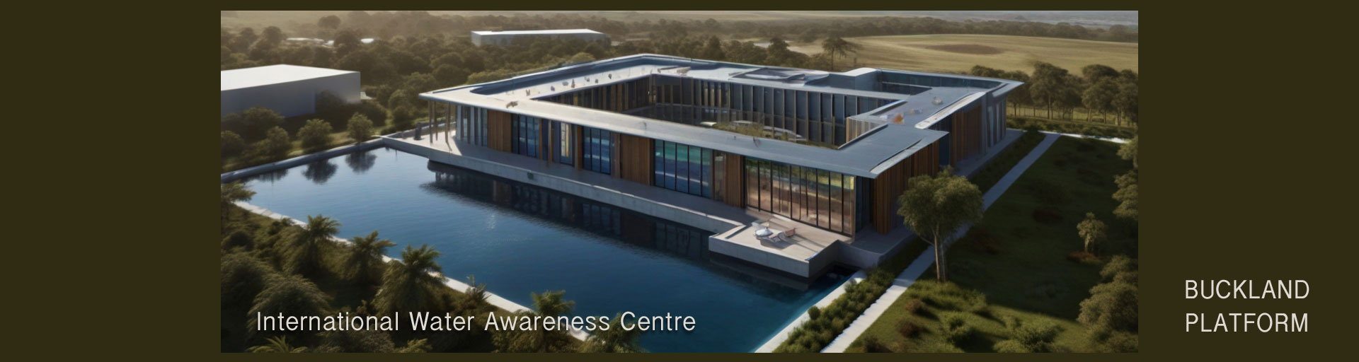
The Buckland Platform (above) at IWAC – the proposed home of WOW’s Global Hydrological Model.
By modeling the Water Cycle of our own planet, we will save valuable time for future generations – time we currently waste as we pollute much of the evidence needed for accurate modeling.
Creating a digital platform to model Earth’s Water Cycle is more than just a technological step for mankind; it’s a lens through which we can study our blue planet, and adapt to explore water on other worlds.
The Digital Twin Earth (DTE) Approach
Adding all water cycle data to a Digital Twin Earth (DTE) model is an immense undertaking, requiring more time than imaginable. This is where AI comes in, handling much of the number crunching as it never sleeps. The model needs to be seamless, linking to related models such as ERSEM, HadOCC, NEMOVAR, and NEMO (https://www.nemo-ocean.eu/). The DTE concept represents a step-change in spatial resolution of Earth observations, enabled by recent advances in synthetic aperture radar, hyperspectral sensors, and high-performance computing. This new era of big data in satellite-based remote sensing, with the proliferation of CubeSats and small satellites, allows for unprecedented detail in our water cycle models.
Visionary Applications
As John C. Jones envisioned in 2009, “Imagine a space where results from altering river positions and flows, constructing dams and mining aquifers can be simulated to assess drought and earthquake risks.” This visionary tool will increase our understanding of water’s role on our blue planet, helping us become better stewards and unlocking insights for a perpetually sustainable future as we navigate hydrological complexities beyond our solar system.
The ESA Digital Twin Earth Programme
The European Space Agency (ESA) is at the forefront of this initiative with its Digital Twin Earth programme (ESA DTE). This program aims to support Member States in creating conditions for strong uptake of novel Earth Observation (EO) capabilities in the future design and implementation of operational Digital Twins ecosystems. ESA DTE focuses on bringing the latest EO-based products, science results, and capabilities to a pre-operational level. It aims to develop a comprehensive set of novel EO-based Digital Twins Components (EO DTCs), designed to demonstrate the potential value of EO for the future evolution of DestinE alongside national digital twin initiatives. For more information on the ESA’s Digital Twin Earth programme, visit: https://www.frontiersin.org/journals/science/articles/10.3389/fsci.2023.1190191/full
Challenges and Opportunities
To scale up a DTE for hydrology, we need to:
- Assess high-resolution products across regions and climates
- Integrate compatible, multi-scale EO data and models
- Manage uncertainty in data
- Implement collaborative research infrastructures
Various planned satellite missions will further facilitate a DTE for hydrology, benefiting global water management if we address the scientific and technological challenges identified.
Physical Models: Complementing Digital Twins
While digital platforms are invaluable for understanding and simulating complex natural systems, physical models still play a crucial role. The Lower Mississippi River Basin Model https://friendsofmrbm.org/model-history/ for instance, aided researchers from 1949 to 1973 in comprehending the intricacies of river dynamics.
At our planned International Water Awareness Centre, we envision a physical model of the Earth’s Water System, digitally annotated with sophisticated animations. This hybrid approach will provide researchers and the public with insights into the behavioral changes of natural elements in the presence of unnatural ones, such as pollution.
Understanding the Global Water Cycle
To fully appreciate the complexity of our global water model, it’s crucial to understand the basics of the water cycle. The water cycle, also known as the hydrologic cycle, is a biogeochemical cycle that describes the continuous movement of water within the Earth and atmosphere. It’s a complex system involving many processes such as evaporation, precipitation, and runoff. For a comprehensive overview of the water cycle, visit: https://en.wikipedia.org/wiki/Water_cycle
The Role of Earth Observation Satellites
Earth observation satellites play a crucial role in monitoring and understanding the global water cycle. These satellites provide valuable data on precipitation, soil moisture, ocean salinity, and other key components of the water cycle. NASA’s Global Precipitation Measurement (GPM) mission, for example, provides global observations of rain and snow to help improve our understanding of Earth’s water and energy cycles. To learn more about NASA’s efforts in studying the water cycle, visit: https://gpm.nasa.gov/education/articles/nasa-earth-science-water-cycle
Conclusion
The Digital Twin Earth Hydrology Platform offers a groundbreaking solution for monitoring and simulating the terrestrial water cycle. By integrating high-resolution satellite Earth observation data with advanced, spatially distributed modeling systems, we can explore large-scale applications to forecast flash floods and landslides, enable precision agriculture, monitor fires, and develop what-if scenarios for flood risk assessment and water resources management.
As we continue to develop and refine this global water model, we’re not just creating a tool for current use. We’re building a legacy that will help future generations understand, manage, and protect our planet’s most precious resource.
This digital twin of Earth’s water cycle is more than a technological marvel – it’s a key to unlocking a sustainable future for our blue planet and beyond.

Update Ref: iwac/j3